Founder and Principal Scientist Resi Solutions Albuquerque, New Mexico
Presentation Description: Solar energy development requires large amounts of land. As the energy transition accelerates, management challenges related to biological resource impacts will become increasingly acute. Legacy survey methods and protocols are often highly labor intensive and expensive. There is an growing need for newer, more efficient methods that can be deployed to produce landscape-scale assessments of critical resources to inform project siting, design, and implementation. AI-assisted drone surveys represent one such method that can help us efficiently address resource impacts at large spatial scales.
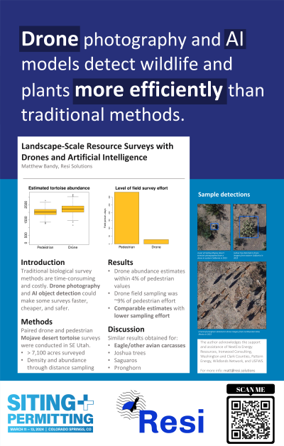
Resi has developed a family of survey methods based on convolutional neural networks and commodity aerial platforms that can generate quantitative abundance and density measurements for a variety of resources at a fraction of the field time and cost of traditional survey methods. These methods include desert tortoise surveys, saguaro surveys, Joshua tree surveys, and pronghorn surveys. In each case, the drone/AI method produces density and abundance estimates for large areas at a fraction of the cost and time of traditional survey methods.

 photo")