Associate, Environmental Compliance and Strategy Invenergy LLC Denver, Colorado
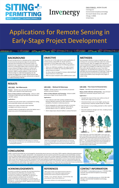
Presentation Description: Remote sensing serves as a valuable tool to understand a preliminary area of interest in early-stage siting, a time when publicly available data or site-specific and field-based biological and environmental resources studies may be logistically or fiscally infeasible. With the passing of the Inflation Reduction Act and other drivers, increasing demand for renewable energy generation and accompanying transmission capacity is often countered by an increasingly complex resource and regulatory landscape, necessitating an accurate and precise understanding of resources as early as possible. The use of remote sensing as a tool presents an opportunity to collect such data with increased efficiency, accuracy, and precision, and should be considered when limited land control presents a barrier to the traditional natural resource surveys. To serve as examples of how technology application can make the environmental siting process more efficient, we highlight applications of remote resource sensing utilizing Light Detection and Ranging (LiDAR) and ultra-high-resolution aerial imagery for preliminary siting assessments. Examples will include: identification of underground features which may serve as potential portals and bat hibernacula; mapping of potential wetland and waterways to understand placement and connectivity; and, characterizing existing species-related habitat conditions and changes over time.

.jpg "Emily Rybacki, M.E.Sc (she/her/hers) photo")